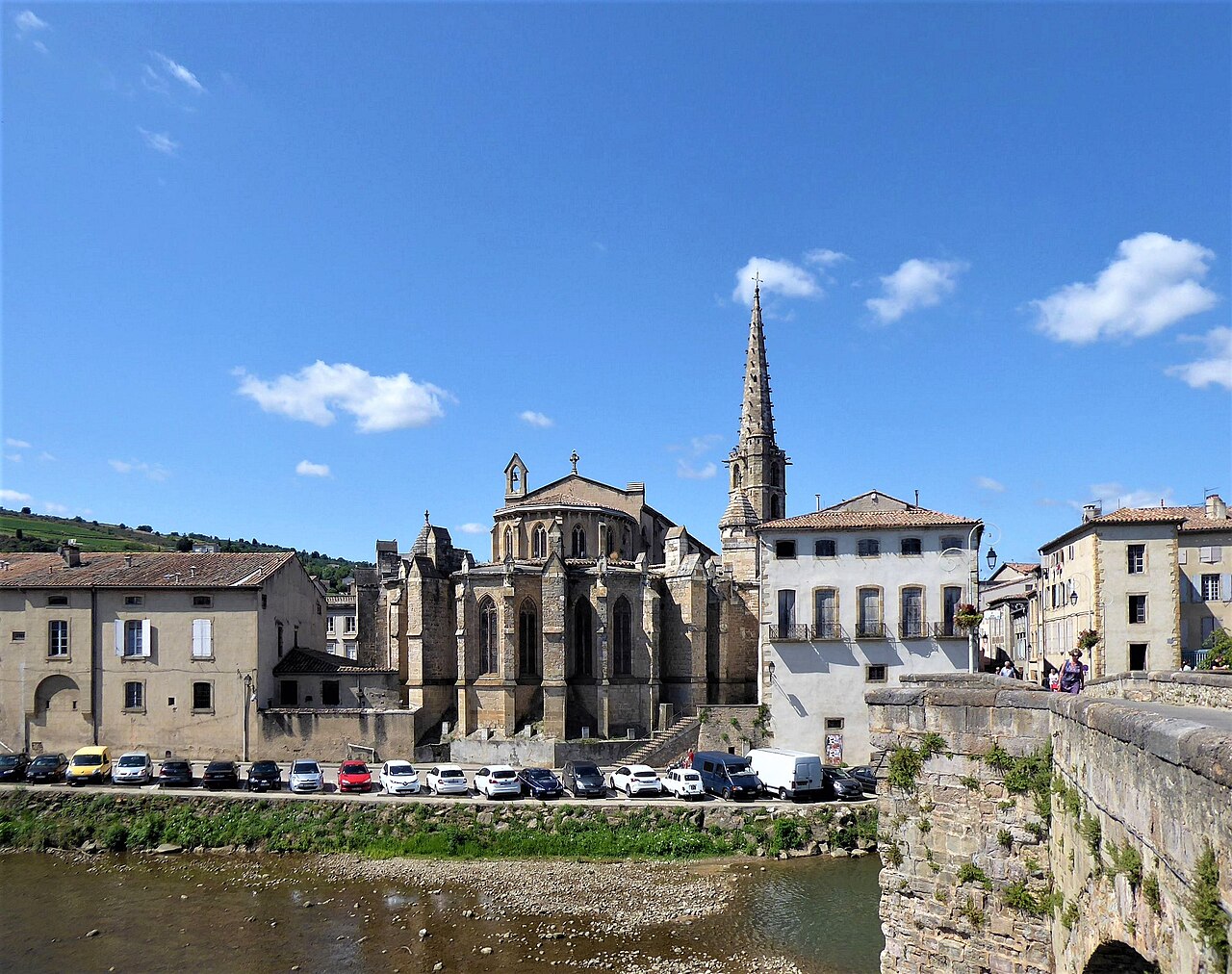
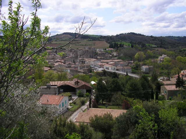
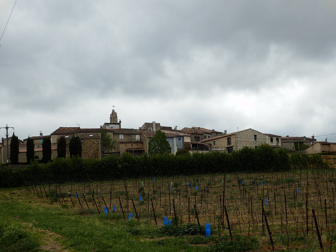
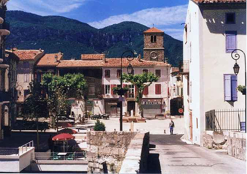
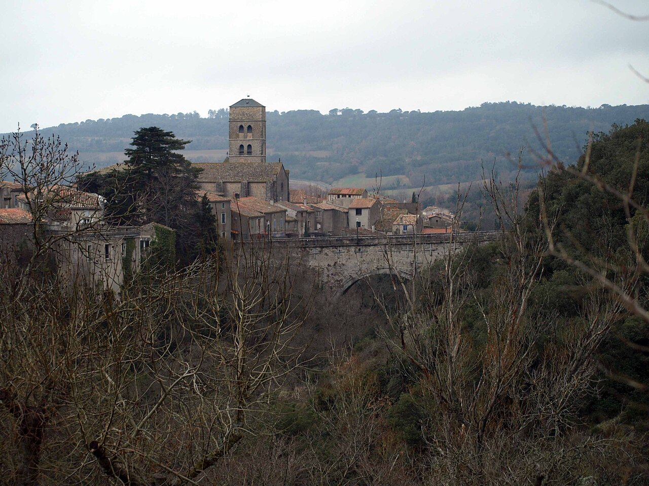
Limoux · Chris06 · CC BY-SA 4.0. Displayed with a responsive crop; original file retained.
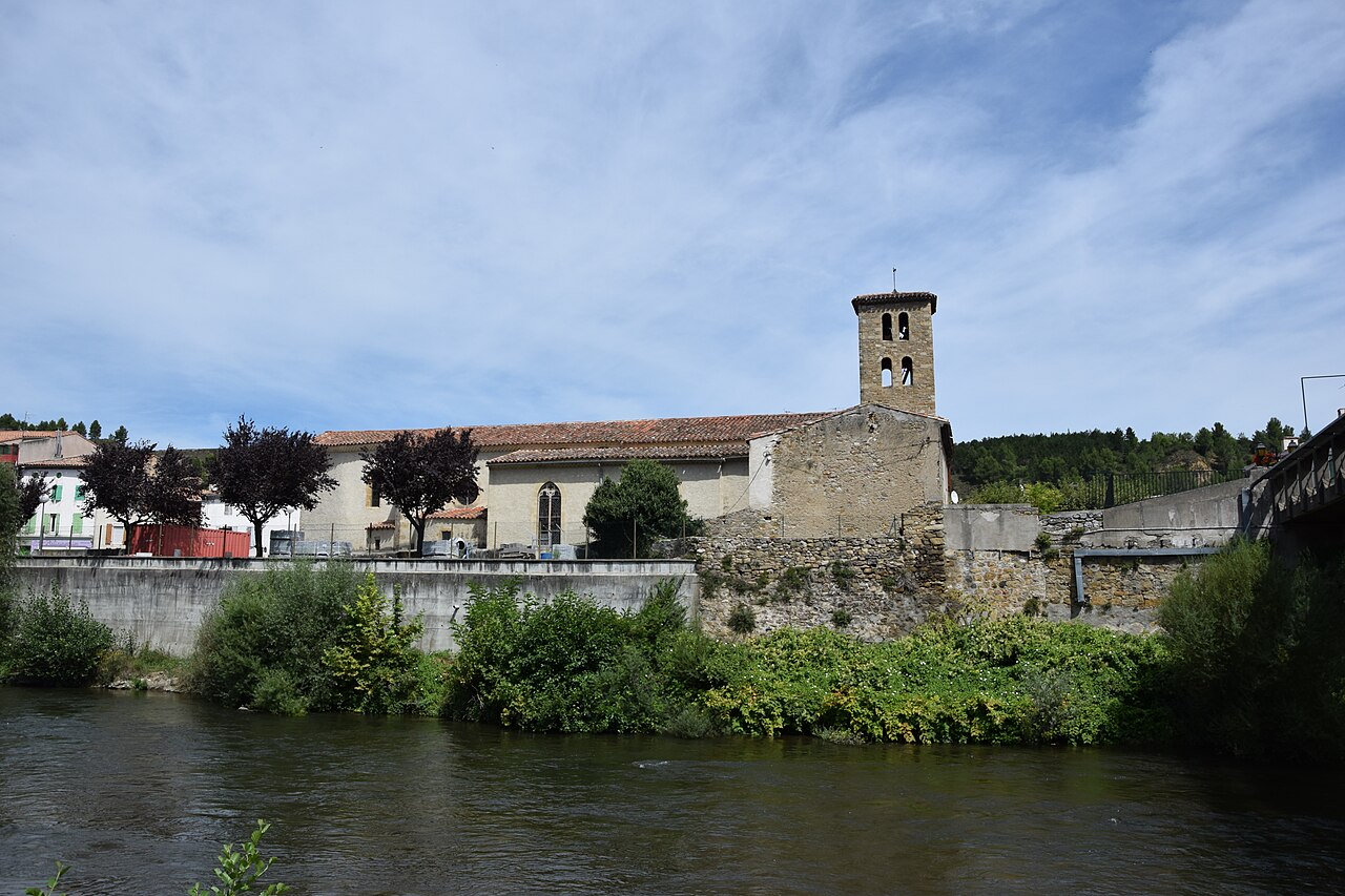
Limoux makes a friendly base because its geography is easy to read: the Aude runs through town, vineyards rise beyond it, and everyday life gathers under the stone arcades of Place de la République. The square has been a marketplace for centuries. Its present mix of old pillars, reconstructed arcades, cafés and fountain makes the town’s long history feel lived in rather than sealed behind museum glass.
Look closely
Walk the arcades and compare their uneven stone supports, then find Venus rising from the fountain at the center of the square.
Limoux developed beside the Aude from settlements with roots in the Gallo-Roman period. A ninth-century royal charter is the first known written mention of the town. Medieval authority shifted among the archbishops of Narbonne, the counts of Razès and the French crown, while bridges and gates tied the growing settlement to roads through the upper valley.
Place de la République preserves the town’s social center. Its fabric spans the fifteenth to eighteenth centuries, but it is no untouched medieval set: a 1673 fire destroyed twenty-six houses and one covered side. Much of the rebuilding used stone instead of the earlier earth construction. The fountain and its Venus were added in 1879, another layer in a square that keeps changing while serving the same communal purpose.
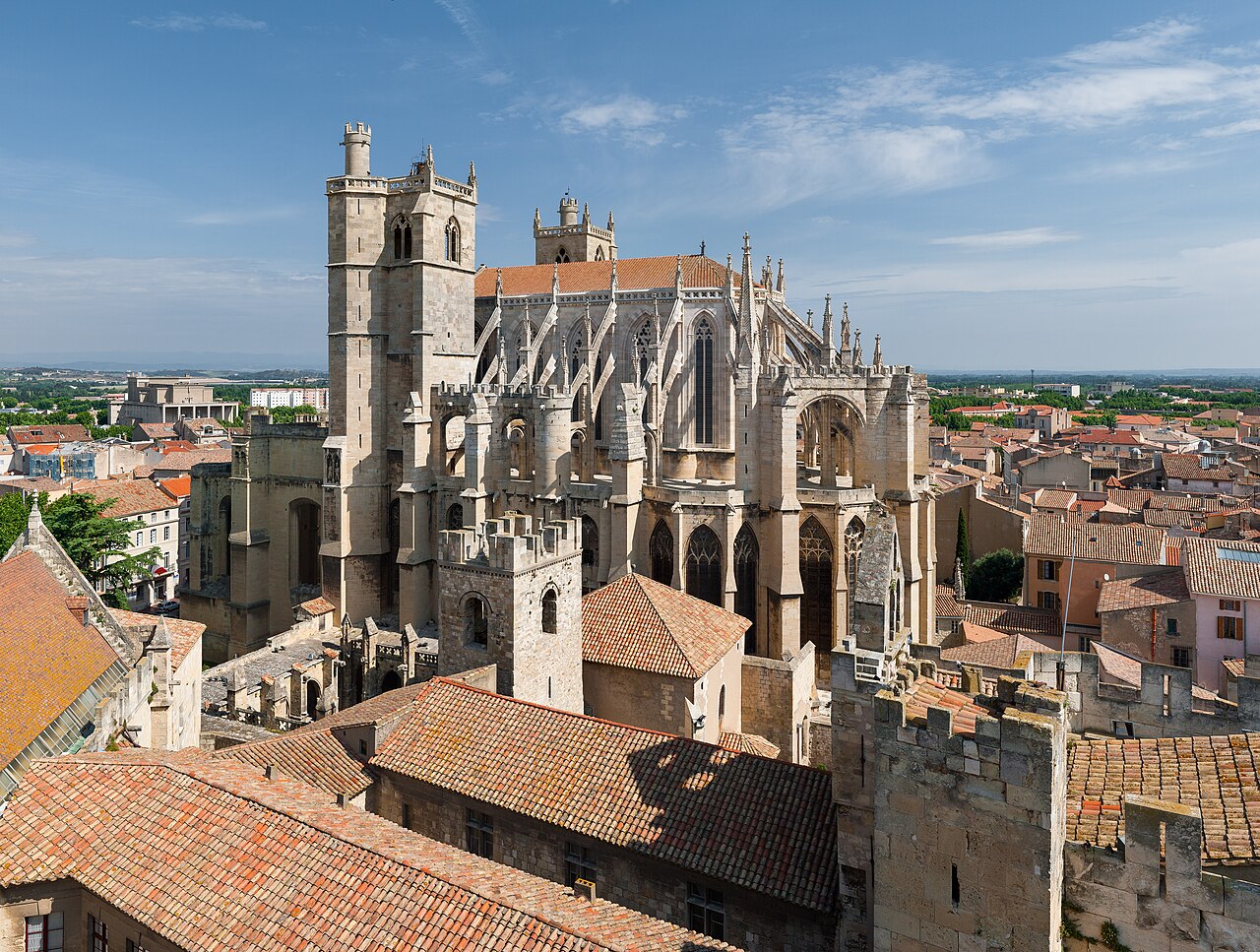
Narbonne Cathedral · Benh LIEU SONG · CC BY-SA 3.0. Displayed with a responsive crop; original file retained.
Narbonne’s center compresses two thousand years into a short walk. A piece of the Via Domitia lies open in front of the archbishops’ palace; nearby, the Gothic cathedral rises to a choir more than forty metres high, then stops before becoming a complete church. Continue to the canal and the shop-lined Pont des Marchands, where one surviving arch hints at a river crossing once far wider than today’s Robine.
Look closely
Inside the cathedral, stand where the soaring choir ends abruptly; at the canal, look for the single visible arch beneath the inhabited bridge.
Rome founded Narbo Martius in 118 BC beside the Via Domitia, the road linking Italy and Iberia. A well-preserved stretch of its paving was uncovered in Place de l’Hôtel de Ville in 1997 and remains visible below today’s street level. The Pont des Marchands continued the southern approach across the ancient Aude and probably had at least six arches; only one remains visible.
Medieval Narbonne expressed a different kind of power through its archbishops. Work on Saint-Just-et-Saint-Pasteur began in 1272, and the choir was largely built by 1340. The cathedral remained unfinished when extending it met the city’s defensive walls and civic opposition to demolishing them. Its abrupt western end therefore records a negotiation between an ambitious church, urban government and the need for fortification.
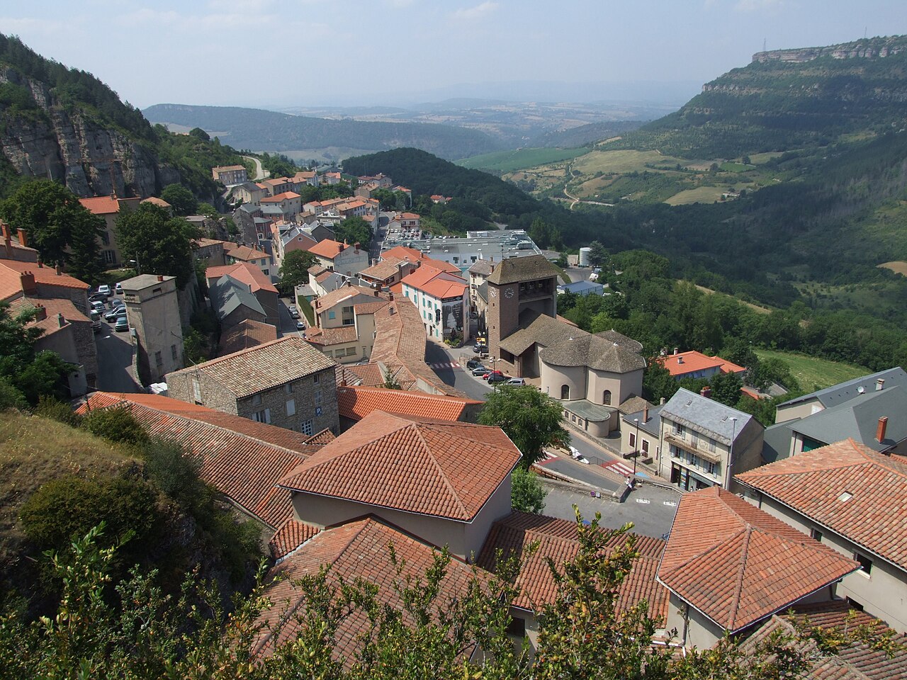
Roquefort-sur-Soulzon · Christophe.Finot · CC BY-SA 2.5. Displayed with a responsive crop; original file retained.
Roquefort is a food story written by geology. Long ago, part of the Combalou limestone plateau collapsed, leaving a jumble of rock above natural chambers. Cracks called fleurines connect those chambers to the outside air. Their shifting currents keep the caves cool and humid, creating the conditions in which Penicillium roqueforti develops the blue-green veins of the cheese. Here, the mountain is part of the recipe.
Look closely
Find a moss-edged fleurine and feel for moving air; nearby doors and shutters let cellar workers fine-tune that natural ventilation.
The cellars sit beneath the north-facing scree of the Combalou and descend through as many as eleven underground levels. Airflow reverses as outdoor temperature changes: warm conditions push cool, humid air inward, while colder weather can draw cave air out. Ripeners regulate the currents with doors and hatches, combining a natural system with close human observation.
Roquefort’s identity is protected as carefully as its caves. French law recognized its designation of origin in 1925, and today the PDO rules require raw, whole milk from Lacaune sheep and ripening in the Combalou cellars at Roquefort-sur-Soulzon. The process turns a regional landscape—pastures, flock, fungus, rock and moving air—into a cheese whose origin is inseparable from this village.
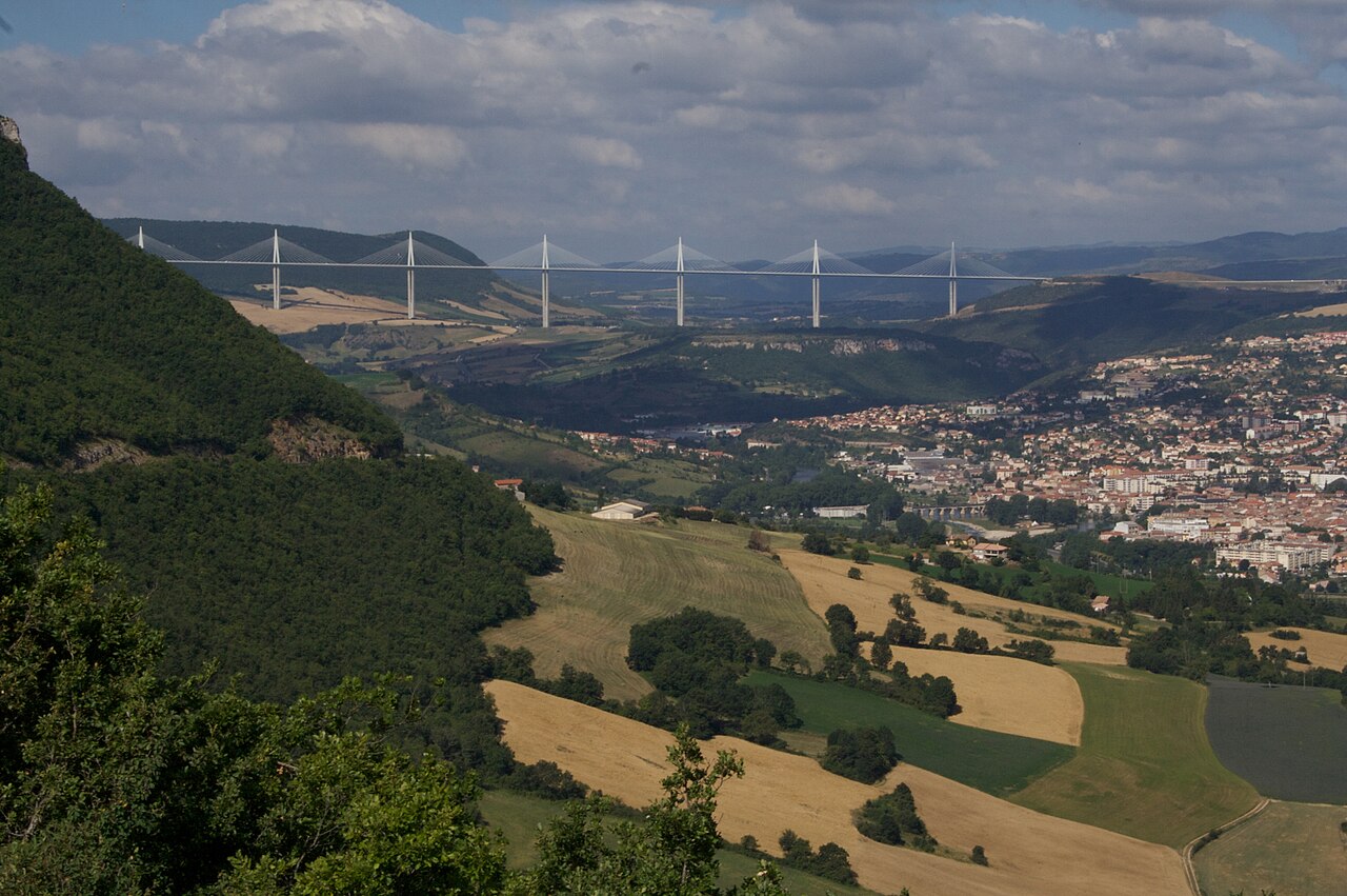
The Millau Viaduct crosses the Tarn valley in one slender, slightly curved line. Engineer Michel Virlogeux and architect Norman Foster shaped a multi-span cable-stayed bridge whose seven concrete piers taper and divide as they rise. At 2,460 metres long, it is enormous, yet the repeated masts and pale cables make it appear almost transparent against the plateau—a piece of motorway designed as part of the landscape.
Look closely
Watch each concrete pier divide below the deck, a forked shape that adds flexibility while making the massive supports look unexpectedly light.
Plans for a high crossing west of Millau emerged after studies began in 1987. A jury selected the Virlogeux and Foster concept in 1996, and Eiffage received the construction concession in 2001. The bridge opened in December 2004 after three years of construction, completing a difficult link in the A75 route across the Massif Central.
Its structure pairs high-performance concrete piers with a steel deck and steel pylons. Workers assembled deck sections on both plateaus, then pushed them out over the valley toward each other using temporary supports. The tallest pier rises about 245 metres to the deck; with its pylon, the structure reaches 343 metres. The numbers impress, but the design’s achievement is making those forces legible and calm.
Saint-Hilaire is a compact Benedictine abbey set among vineyards, with a Gothic cloister, Romanesque church and rooms built for communal life. Its most arresting object is a twelfth-century marble relief associated with the anonymous Master of Cabestany. Often called a sarcophagus, it was probably made as an altar-reliquary. Read from right to left, its crowded figures narrate the arrest, martyrdom and burial of Saint Saturnin.
Look closely
Read the marble relief from right to left and notice its deeply drilled eyes, angular hands and figures squeezed into the stone frame.
The abbey’s origins are uncertain, though local tradition connects the site with Hilaire, sixth-century bishop of Carcassonne. By the early ninth century, a royal charter confirmed donations and the monks’ right to elect an abbot under the Benedictine rule. The surviving complex accumulated over centuries: church, cloister, refectory, abbot’s lodging and cellars all reveal different periods of monastic life.
A second tradition links Saint-Hilaire to sparkling wine. Local wine bodies date the discovery of bubbling Blanquette to 1531, while the earliest surviving written mention cited by the appellation is from 1544. Treat the monk-and-bottle tale as local tradition rather than a witnessed invention story. The firmer point is that sparkling Limoux wine has a documented sixteenth-century history rooted in this area.
La Digne-d’Aval, home to Domaine J. Laurens · Tybo2 · CC BY-SA 4.0. Village context photograph; not a photograph of the estate. Displayed with a responsive crop.
At J. Laurens, the regional wine story becomes a sequence you can follow from grape to bottle. The estate near La Digne-d’Aval makes only sparkling Limoux wines, including Blanquette and Crémant. Mauzac gives Blanquette its local accent, often recalling green apple and orchard fruit. The cellar connects that grape to the traditional method: one fermentation makes wine, then another inside the bottle creates the bubbles.
Look closely
Look for bottles resting neck-down and ask how riddling gathers spent yeast near the cap before the final disgorgement clears it.
Michel Dervin, a sparkling-wine specialist from Champagne, founded the estate in the 1980s after recognizing the possibilities of Limoux’s vineyards. Jacques Calvel took it over in 2002 and expanded and modernized the operation with cellar master Henri Albrus. The estate now works more than fifty hectares around La Digne-d’Aval and focuses on the area’s protected sparkling wines.
Blanquette and Crémant share bottle fermentation but express different blends. Mauzac is the defining grape of Blanquette; Crémant also draws strongly on Chardonnay and Chenin, with Pinot Noir permitted. After the second fermentation, time on the lees adds texture. Riddling gradually moves the deposit into the neck, then disgorgement removes it. Those visible cellar steps explain why a finished bottle holds both agriculture and careful choreography.
Quillan sits where the upper Aude valley begins to tighten toward the Pyrenees. The river divides the town, wooded hills press close, and a square ruined castle watches from the right bank. That compact geography explains Quillan’s old role as a gateway and administrative center. The market belongs to the lived-in town below; the castle above recalls the archbishops of Narbonne, who once governed from this strategic valley position.
Look closely
From the lower town, pick out the castle’s square plan and surviving corner turrets, then notice how tightly river, road and hills converge.
Local tradition derives Quillan’s name from the three surrounding hills, the ‘three quilles.’ Its castle was established by the fourteenth century on the Aude’s right bank. Built around a square with four corner turrets and a tall gate tower, it served the administration of the archbishops of Narbonne and could also house them when they traveled through the valley.
The stronghold was damaged during conflict between France and Aragon, later cut down and adapted as an artillery battery. Like many abandoned fortifications, it then became a convenient stone quarry for other buildings. Archaeological campaigns and partial restoration have since made its outline readable again. Seen above the market streets, the ruin is a useful reminder that this small town once occupied a sensitive route toward the borderlands.
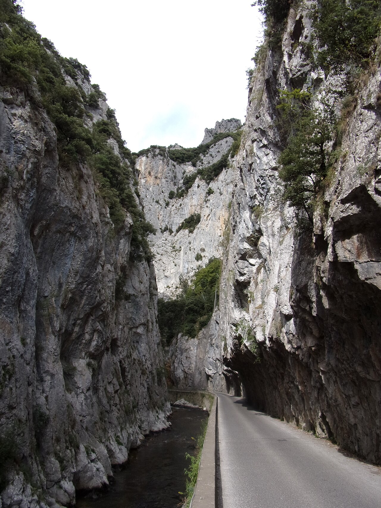
The D118 seems to borrow its path from the Aude as both squeeze between steep limestone walls. This passage was not always a road. In the late eighteenth century, Abbé Félix Armand and people from Saint-Martin-Lys began cutting a way through the rock to end their village’s isolation. The opening remembered as the Trou du Curé turned an apparent barrier into a route through the upper valley.
Look closely
At the Trou du Curé, notice how the road’s cut edge meets the natural cliff: the human passage is tiny beside the gorge.
When Félix Armand became parish priest in 1774, Saint-Martin-Lys lay hemmed in by the Aude and the cliffs of Pierre-Lys. He spent decades pressing for and helping create a road through terrain previously considered impassable. The first hand-cut opening became the Trou du Curé—the Priest’s Hole—and remains the emblem of the effort by Armand and his parishioners.
Later engineering widened and reshaped the route for modern traffic, so today’s tunnels and roadway should not all be mistaken for eighteenth-century work. What survives is the larger idea: access changed the fortunes of communities along the valley. The gorge also makes the region’s geology immediate. The river cut through a resistant limestone barrier, and the road follows the narrow opening rather than mastering it.
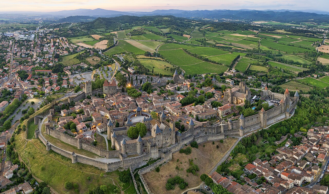
Carcassonne’s double walls and pointed towers look like a complete medieval vision because the nineteenth century helped make them one. By then, the fortress had lost its strategic purpose and parts were ruined or quarried for stone. Eugène Viollet-le-Duc studied, repaired and also interpreted the remains, aiming to recover a coherent thirteenth-century Cité. What you see is both a major medieval fortification and a landmark in the history of restoration.
Look closely
Compare tower roofs as you walk: Viollet-le-Duc’s slate choices were controversial, and their sharp silhouettes still shape the Cité’s identity.
Carcassonne became a royal frontier fortress in the thirteenth century, facing the kingdom of Aragon. After the 1659 Treaty of the Pyrenees moved the political frontier south, its military role faded. Residents increasingly favored the lower Bastide Saint-Louis, and the upper Cité declined; houses crowded the space between the walls while damaged masonry supplied local building stone.
Local scholar Jean-Pierre Cros-Mayrevieille helped secure protection, and restoration began in 1852 under Viollet-le-Duc. He repaired walls, roofs, gates and towers, cleared buildings from the lices, and sometimes completed features according to his theory of an ideal historical state. Paul Boeswillwald continued after his death in 1879. The work drew criticism, yet it became inseparable from the monument UNESCO listed in 1997.
Espéraza’s Sunday stalls occupy a town shaped by two unlikely trades: timber rafting and felt hats. Rafts once carried logs down the Aude toward the coast; from the mid-nineteenth century, hat making turned the valley town into an industrial exporter. That business faded after the 1950s, but its memory remains visible. The later discovery of rich fossil beds nearby gave Espéraza a second, very different identity.
Look closely
Notice the town’s industrial scale around the river and former station, then look for old hat-making references among today’s market signs and museums.
For centuries, Espéraza’s workers handled the resources moving along the Aude. Radeliers guided rafts of timber downstream for fuel, buildings and, from the seventeenth century, ship construction. Tanneries, fulling mills and grain mills also used the river. The settlement was rebuilt on its present site from the thirteenth century and later became part of the French crown’s direct holdings.
In the mid-nineteenth century, wool-felt hat production transformed the town into an industrial center with international sales. Fashion changes and limited diversification drove a steep decline after the 1950s. Then nearby Late Cretaceous fossil discoveries opened another chapter in the 1980s. The town’s own history page mistakenly calls dinosaurs mammals; they were reptiles, and the museum’s scientific account is used for the paleontology story.
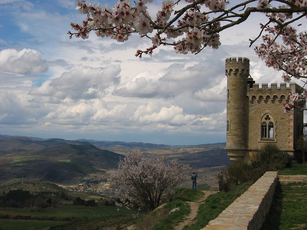
Rennes-le-Château is small enough to cross in minutes, but its ridge-top view and one priest’s building campaign inspired an industry of speculation. From 1885 to 1917, Bérenger Saunière renovated the church and created an elaborate estate, including Villa Bethania and Tour Magdala. Questions about how he paid for it fed stories of buried treasure. The panorama and eccentric architecture are real; the treasure remains a local legend.
Look closely
In the church, find the unusual painted and sculpted details Saunière commissioned; outside, let the wide valley view explain the village’s allure.
The documented story centers on Saunière, parish priest from the late nineteenth century. He repaired the church of Saint Mary Magdalene, bought adjoining land and developed a personal domain with a villa, gardens and a neo-Gothic tower. His unexplained spending prompted church scrutiny during his lifetime and later gave storytellers the raw material for increasingly elaborate theories.
Local legend claims that hidden documents or treasure financed the work. No accepted historical evidence establishes a cache, a secret bloodline or the other claims later attached to the village. Those ideas grew through twentieth-century books and popular culture. Labeling them as legend makes the place more interesting, not less: visitors can compare a verifiable architectural project with the way mystery accumulates around unanswered questions.
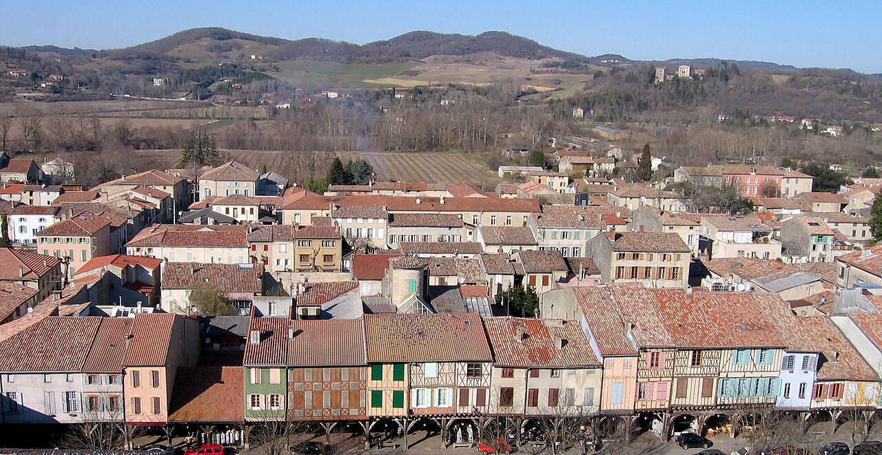
Mirepoix and its medieval centre · BastienM · CC BY-SA 3.0. Displayed with a responsive crop.
Mirepoix’s market square is a room made from houses. Fifteenth-century covered walks run beneath timber-framed upper floors, sheltering trade and conversation around the edges. The Maison des Consuls turns its structure into a carved crowd: human faces, animals and scenes of daily life project from the ends of the beams. The square’s beauty is not just symmetry; it is the odd, hand-made detail hiding above eye level.
Look closely
Under the Maison des Consuls, count faces and creatures among its 104 carved beam ends; each small figure changes the rhythm overhead.
The earlier town stood on the opposite bank of the Hers until a catastrophic flood in 1289. Mirepoix was rebuilt on the left bank with the ordered plan associated with southern medieval bastides. Its broad central square became the commercial heart, and the covered passages that survive around it date mainly from the fifteenth century.
The Maison des Consuls served in turn as a place of justice, civic residence and prison. Its two rows of carved modillons show faces, animals and everyday scenes. Nearby Saint-Maurice began in 1297 and grew over six centuries; its unusually broad single nave expresses the southern Gothic preference for one large preaching space. Together, church and market square reveal the religious and civic ambitions of the rebuilt town.
Montolieu did not inherit an ancient bookselling tradition; it deliberately invented one. In 1990, Carcassonne bookbinder Michel Braibant began a project to preserve the arts and crafts of the book. A museum opened the next year, secondhand dealers joined it, and the hillside village became a place where bookshops, workshops and street art share narrow lanes above two river gorges. Its identity is recent, specific and still visible.
Look closely
Watch for book-themed metal sculptures above the lanes, then step into a shop and notice how old bindings turn shelves into a color study.
Montolieu occupies a rocky spur on the lower slopes of the Montagne Noire, between the Alzeau and Dure rivers. Its older stone fabric supplies the setting, but the ‘Village of Books’ story begins only in 1990. Braibant imagined a rural center where printing, binding, paper and secondhand books could support both memory and local life.
The book museum opened in 1991, and dealers in old and used editions established shops alongside it. Artists and craftspeople broadened the idea beyond retail, filling streets with sculpture and workshops. That layered reinvention is the point to notice: Montolieu uses an inherited village form to house a modern cultural project, showing how a small place can choose a new specialty without pretending it has always been there.
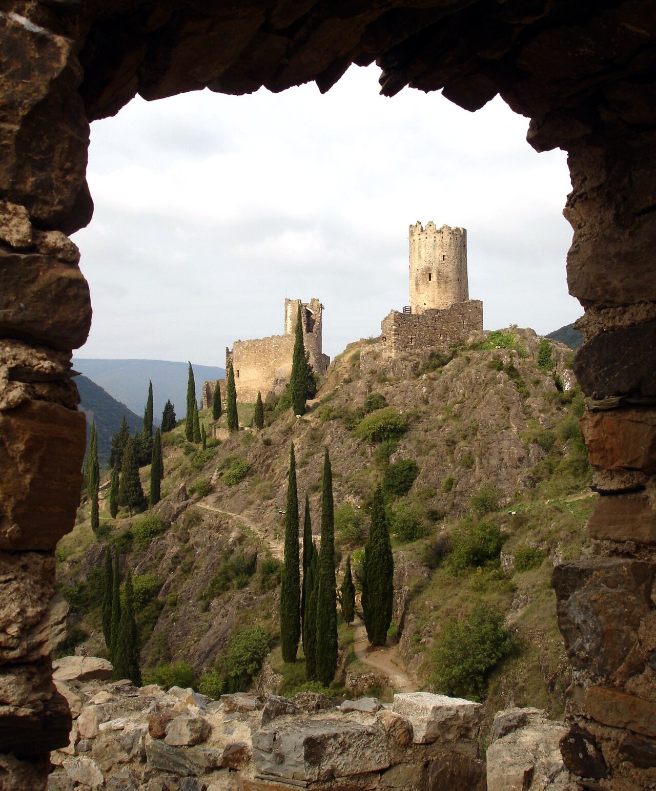
Four ruined castles now punctuate the same narrow ridge at Lastours, but they are not simply four survivors from one moment. The medieval lordship of Cabaret first had three castles tied to separate fortified settlements. After the Albigensian Crusade and royal takeover, those sites were destroyed and a new defensive group of four rose along the crest. The famous silhouette is therefore a royal rearrangement of an older landscape of power.
Look closely
From the opposite belvedere, trace the four sites along one spine and notice how the ridge itself works like a shared defensive wall.
Cabaret, Quertinheux and Surdespine formed the core of a prosperous twelfth-century co-lordship enriched by nearby copper, silver and lead deposits. Fortified villages clustered around the castles, and archaeology has recovered tools and household objects as well as defenses. The lords of Cabaret supported the Trencavel viscounts and sheltered Cathar religious figures, drawing crusading armies to the site.
After the French crown gained control in the thirteenth century, Louis IX ordered the old castles and settlements destroyed. Royal builders then established the four monuments seen today: Cabaret, Quertinheux, Surdespine and Tour Régine. Their aligned positions controlled the Orbiel and Grésilhou valleys while announcing a new authority. The belvedere reveals that political change more clearly than any single tower can.
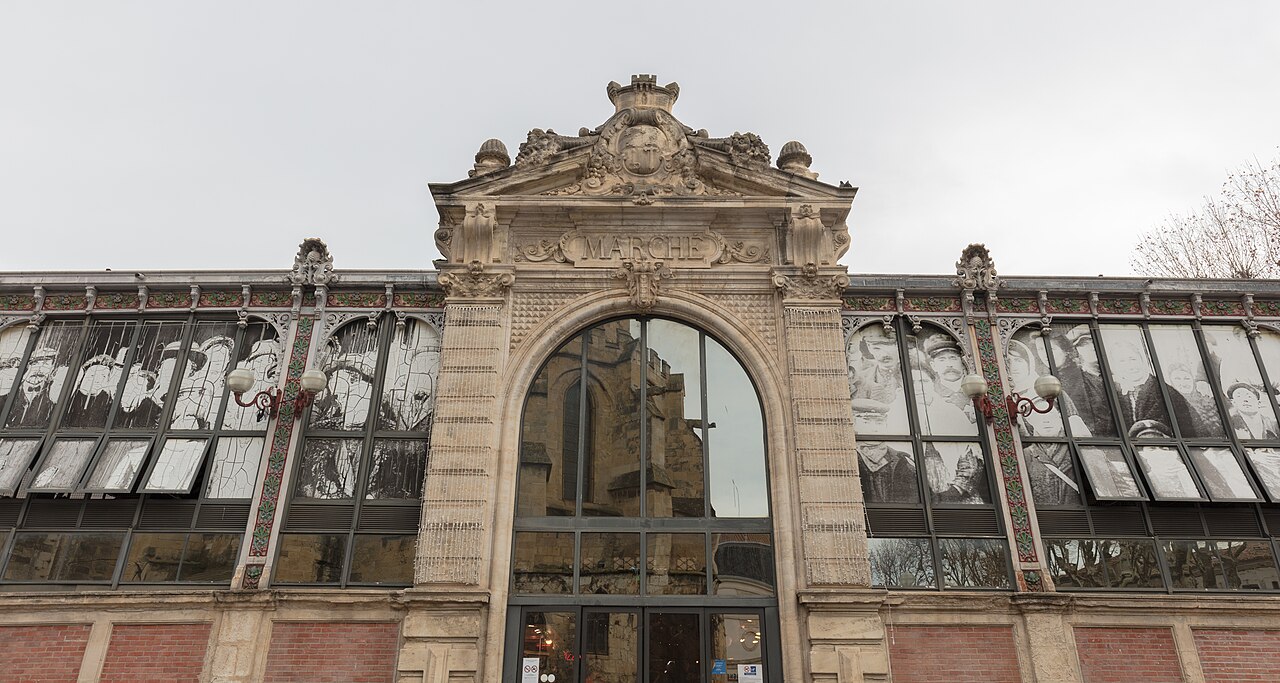
Les Halles turns breakfast into a lesson in industrial-age architecture. The city opened this iron, glass, brick and stone pavilion in 1901 after the older open market on Place aux Herbes became too small. Its broad roof and metal frame clear away heavy interior walls, leaving light and room for people and produce. Decorative ceramics, stone doorways and the city arms keep the practical structure from feeling like a shed.
Look closely
At the main entrance, find grapes in the decoration—a nod to Narbonne’s wine economy—then look up at the riveted metal skeleton.
Narbonne debated a new covered market from the 1870s as the stalls near the archbishops’ palace outgrew their square. Architect Léopold Carlier drew the pavilion, and Marseille contractor André Gabelle built it near the Canal de la Robine. Construction began in 1899; after disputes over finishing work, merchants moved in at the start of 1901.
The design belongs to the Baltard tradition of late nineteenth-century market halls, using factory-made materials to span generous, well-lit interiors. Brick, iron, glass and glazed ceramic could be assembled quickly while monumental stone doors gave the civic building weight. Grapevine motifs refer to the local wine trade, and the city crest above the entrance recalls the medieval walls that once occupied the site.
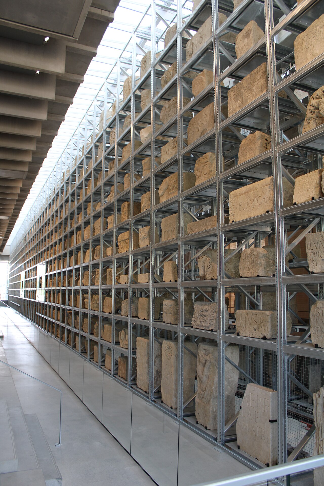
The lapidary wall at Narbo Via · Zunkir · CC BY-SA 4.0. Displayed with a responsive crop.
Narbo Via’s central wall is part exhibition, part storeroom and part working machine. A double steel rack, ten metres high and seventy-six metres long, holds 760 carved Roman blocks—many reused centuries later in Narbonne’s defenses. A built-in lifting system can move them for study or redisplay. The installation makes archaeology feel provisional: each fragment has left one building, entered another, and can still change position as knowledge grows.
Look closely
Scan the wall for repeated leaves, letters and portrait fragments; empty rack spaces reveal that this impressive display is also an active store.
Roman Narbo Martius was the first Roman colony in Gaul and a major Mediterranean port. Its monuments later became convenient sources of dressed stone. Hundreds of blocks from tombs and public buildings were reused in late and medieval fortifications, then recovered when those walls were dismantled. Their broken inscriptions and ornaments now preserve a scattered archive of the ancient city.
Foster + Partners designed Narbo Via around that condition of reuse. The lapidary wall separates public galleries from conservation and research spaces while keeping the collection visible. Each block rests on a pallet in heavy-duty shelving, and an integrated stacker crane can retrieve it. Rather than reconstructing one imagined Roman façade, the museum shows both the abundance of fragments and the ongoing work required to interpret them.
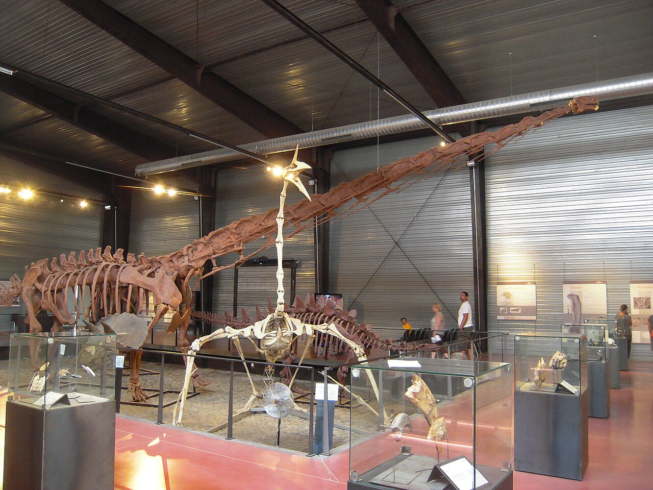
Dinosauria exists because important fossils were found only a few kilometres from Espéraza. Paleontologists began sustained work at the Bellevue site in the 1980s, recovering thousands of bones from the Late Cretaceous. The museum connects mounted skeletons and full-size reconstructions to that continuing research. Its local star is Ampelosaurus atacis, a plant-eating titanosaur known from this valley rather than imported from a distant fossil field.
Look closely
Find ‘Eva,’ the unusually complete Ampelosaurus skeleton, and compare the real fossil bones with the neighboring full-body reconstruction built from them.
Researchers Éric Buffetaut and Jean Le Loeuff began excavating the rich local deposits in the early 1980s. Finds helped define several animals from the region, including the armored-backed sauropod Ampelosaurus atacis, formally described in 1995. In 2001, student Eva Morvan discovered a particularly complete individual later nicknamed Eva, which became central to the museum’s account of local fieldwork.
The collection now includes tens of thousands of specimens—dinosaurs, turtles, crocodiles, fish and ancient birds—available to professional researchers as well as presented to visitors. That dual role matters. Reconstructions make the Cretaceous legible, but the preparation lab, incomplete bones and changing scientific names show how the picture is assembled. Dinosaurs were reptiles; one municipal history page’s description of them as mammals is an error.
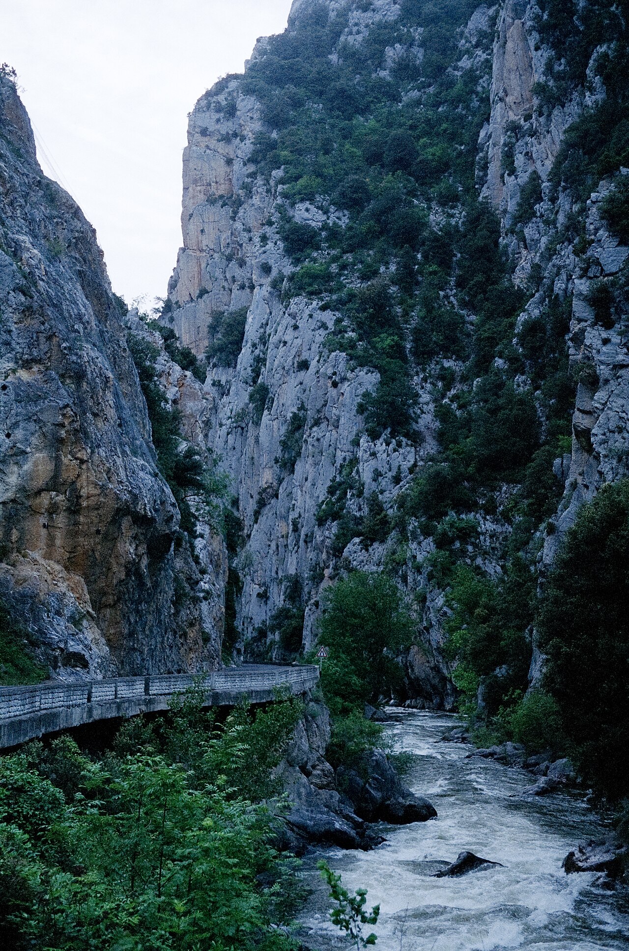
The road through the Gorges de Saint-Georges · TeulièreEric · CC BY-SA 4.0. Displayed with a responsive crop.
Upstream from Axat, the Aude enters an even tighter corridor than Pierre-Lys. The Saint-Georges gorge narrows sharply between high limestone walls. Road and river travel side by side because neither has room to wander. The close rock, shaded water and sudden strip of sky make the gorge a vivid cross-section of how a mountain river exploits fractures and slowly enlarges a passage through the foothills.
Look closely
Watch the gap of sky above the road narrow and widen, then notice fresh rockfall barriers beside much older, water-smoothed cliff faces.
This is primarily a geological story. The Aude descends from the Capcir and cuts across several rock zones before reaching the sedimentary landscape around Saint-Georges. Erosion opened a steep-sided passage through the foothills, leaving the river confined between rock and wooded slopes. Regional studies identify the upper Aude as a chain of deep gorges that includes Saint-Georges and Pierre-Lys.
Human access occupies the same confined line. The D118 and the river share the gorge, while the historic railway and routes around Axat find their own ledges and crossings nearby. Protective works against falling rock are a modern reminder that the cliffs are active terrain. Saint-Georges is an optional extension of the drive: its value is seeing the upper Aude become a mountain river before it flows north through Pierre-Lys, Quillan and Limoux.